Wednesday, June 29, 2016

Blacklock Point

June 20, 2016

Over the past few years we have seen and read fellow hiker postings on Blacklock Point.  So when we discovered that the trail was just a few miles up highway 101 from Cape Blanco SP, it became one of those "priority" hikes for our camping trip.

Time for another hike!

After hiking the South Beach & North Beach of Cape Blanco, hiking to the lighthouse and seeing the Oregon coast for 3 days, you might wonder why drive and then hike just to see another section of coast? But from what we have read and seen, Blacklock Point is not just another section of the coast.

And so the hike begins......

So we drove from Cape Blanco SP out to highway 101, headed north a few miles and then drove along a road to the Cape Blanco Airport.  Parking just outside the airport gate, we headed down the trail which began by winding it's way through the thick coastal brush. We felt like NASCAR drivers as we turned left at each intersection, making sure we were following the signage pointing to Blacklock Point.

A portion of the sandy trail through the thick coastal brush.

At times the trail would split into two trails.  One being the main trail, the other was usually a wooden boardwalk section that would parralel the main trail for a short segment.  These boardwalks are in place due to the often flooded main trail during winter and spring.  We were able to stay on the main trail the entire hike.

Main trail to left, boardwalk trail visible off to the right.

Coastal brush gave to way to some dark forrested area of trail before we emerged into the open and sunshine-filled bluff that leads up to and overlooks Blacklock Point.  Many pictures ensued.

Blacklock Point


Notice all the flowers on the bluff above Blacklock Point

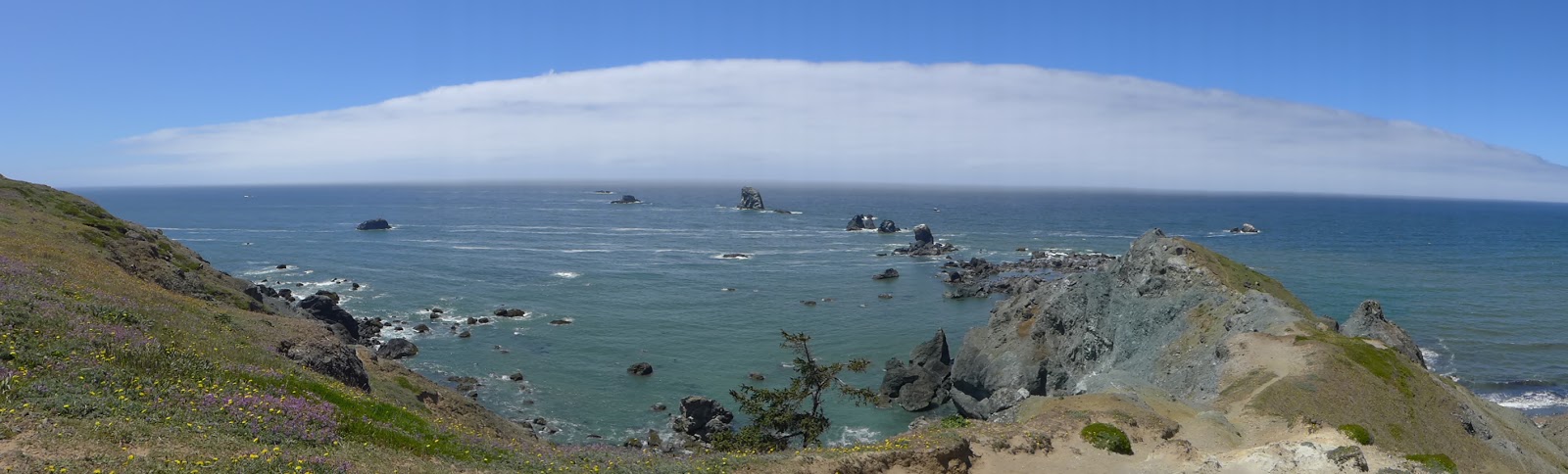
To the south we could view the coastline back to Cape Blanco and the lighthouse.

View from the bluff to the south and Cape Blanco

Looking northward we could see the beautiful scenic cliffs that line the beach down to Lake Floras.
View to the north from the bluff towards scenic cliff area and eventually Floras Lake
Glenn ventured along the trail that goes out onto Blacklock Point, but only to a certain point.  It was very windy and a fear of heights held him back.  That and the fact that Katie was having a fit that her master had lost his mind.

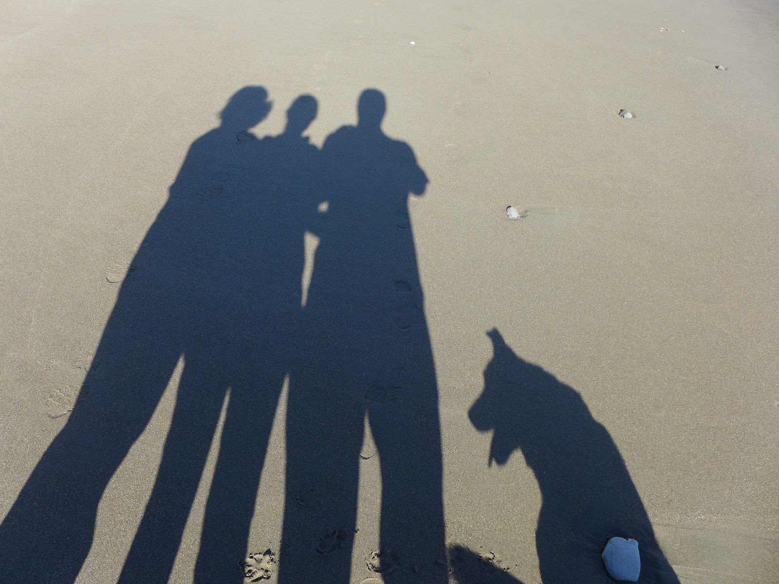
Carol, Maggie, Karen

Carol, Glenn, Maggie and Katie


Carol and Katie soaking up the sun on the bluffs.


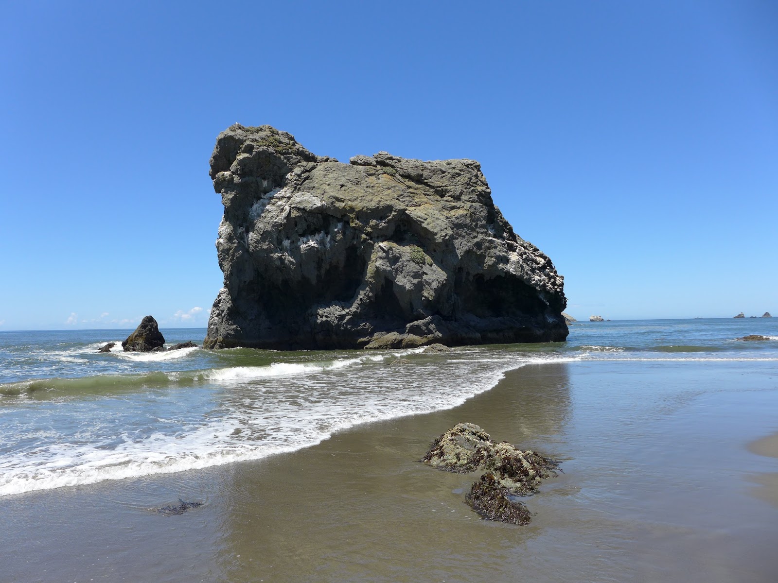
After enjoying the views and taking an eating break, we made our way back along the trail to our car. We then drove back to Cape Blanco SP so we could take in even more views of the coast.  Sorry, just can't get enough of the coast - espcially on a beautiful blue-sky-sunny day!

If you do get a chance to visit Blacklock Point, it is well worth it.  There are some side trails where you can hike down to the beach and even make your way to where the Sixes river meets the ocean.  You can also extend your hike by taking connecting trails all the way to Floras Lake.  Or you could start at Floras Lake and hike south to Blacklock Point.  So many options!   But that's part of the fun in hiking.  So get out and have some fun this summer and take in the beautiful views waiting for you.

Trekking Together
Glenn & Carol (and Maggie and our sister Karen and Katie too)


Sunday, June 26, 2016

Oregon Coast Trail - North Cape Blanco Beach Loop

June 18, 2016

Cape Blanco SP is one of our favorite Oregon State Parks and on our recent camping trip, we took full advantage of the many trails at or near the park.
Time for some great camping!!!
On our first full day, our daughter Maggie joined us as we hiked a loop trail that consisited of the Oregon Coast Trail and the North Beach of Cape Blanco.  Two years ago we hiked this same loop, so we decided to hike the loop in the opposite direction this time - clockwise.

Time for some great hiking too!!!
We began by hiking the Oregon Coast Trail out of the campground area towards the lighthouse.  The trail winds it's way through a dark and sheltered forest before emerging into the sunshine and through the very dense growing brush.  Here too, we got a taste of the wind which is always present at Cape Blanco.  We were also treated to a vast array of wildflowers in bloom while viewing the lighthouse in the distance.
Oregon Coast Trail with the lighthouse in the distance

Some of the dense brush along the Oregon Coast Trail
Meadow Chickweed


After crossing the lighthouse road we descended down to the North Beach.  This beach would be our trail for the next mile or so.  It was a beautiful hike with the blue sky, large driftwood logs, and of course a few Sea Stacks thrown in for good measure.
View along the North Beach

Carol and Maggie on the North Beach

One of the Sea Stacks along the North Beach
Before reaching the Sixes river, we headed back inland and took another short trail through a vast grassy area.
View of our inland trail from North Beach.  Sixes River is visible to the left.
Our plan was to hike this trail over to a day use site next to the Sixes river for a break and views of the river.  When we last hiked this trail, this area was filled with sheep who literally ran from us and Katie.  However, those sheep evidently sold their land to a group of very large cows.  Those very large cows just happened to be laying down right along the trail, as if trying to dare any hiker to pass.  Glenn ventured out twice towards them and both times one of the cows stood up, looked straight at Glenn, and did not budge from it's position. This may have been the mama of the one young calf in the group.  Glenn also at this point forgot to take any pictures of this cow standoff.  So not wanting to make the local 6 o'clock news, we played it safe & turned off our current trail and headed back towards the woods along the Oregon Coast Trail again without going to the day use site along the Sixes river.

Our last leg of the Oregon Coast Trail had a few steep climbs and at times lead us through some very dark woods.  It also provided us with more beautiful views of the North Beach area and Lighthouse from the bluffs until we reached the Lighthouse road and headed back to our camp.

A view of the North Beach from the bluffs along the OCT

OCT through the woods back towards the lighthouse

Panoramic view of North Beach.  We hiked the beach from left to right.

Yup, even Katie enjoyed the views of North Beach
Be sure to check out the Oregon State Parks website for more information about Cape Blanco SP.
We also included some pictures below from our hike along the South Beach area at Cape Blanco the previous day.

Trekking Together
Glenn & Carol (and Maggie too)

View of South Beach from the Bluffs.  Whaleshead rock in the distance.

View of South Beach from the access road

South Beach Sea Stack

Family Photo.  Can you guess who is who?


Thursday, June 2, 2016

PCT: Green Springs Summit to Little Hyatt Lake

May 29, 2016

After getting a taste of hiking the PCT on the Green Springs Mountain Loop trail, we decided it was time to stretch our legs and challenge ourselves with our first 10+ mile hike of the year.  So back up to the Green Springs Summit we went, this time hiking the PCT from the Summit to Little Hyatt Lake and back --- 10.8 miles when done.

What?  Who you calling "trash"?
The first couple of miles took us in and out of various meadows and wooded areas, but both had one thing in common- wildflowers!  This would be the theme for this hike as we were able to identify 34 different wildflower varieties and had about 4 or 5 that we could not identify!  It was absolutely flower filled -see a few samples below.

Wild Iris

Yup, the elusive Mission Bells again!

Oregon Anemone

Striped Coral Root.  Never seen so many on one hike!

Royal Jacob's Ladder
Eventually we arrived at the trailhead for the Green Springs Mountain Loop trail that we hiked a few weeks ago, but this time we continued on the northbound PCT.  It is always interesting to hike the same trail in a different direction, so in a sense, this was new to us too.  We were treated to views of Pilot Rock and still slightly snow covered Mount Ashland.

After departing from the Mountain Loop trail section of the PCT, we continued on, alternating between meadows and forested areas as well as between uphill and downhill.  We even came across one meadow area with some nice rock cairns which we could not pass up without taking a picture.

Another Pitcairn cairn???

No, it's a Katie Pitcairn cairn!


We finally started to hear water and knew we were getting close to Little Hyatt Lake.  How do you hear a lake you ask?  The PCT goes past Little Hyatt Lake just below the little dam and overflow which today made quite a pretty waterfall.  For the backpackers at the lake, it made a nice natural shower.

Little Hyatt Lake dam overflow - great natural shower.
We hiked just a short distance off the trail and found a nice area where we could sit down and drink and eat, while taking in the beauty of Little Hyatt Lake.

Katie posing in front of Little Hyatt Lake.  Ok, begging for food.

Little Hyatt Lake

Downstream from the Little Hyatt Lake dam overflow
Our return hike offered us a second chance to take in all of the beautiful meadows, woods and of course wildflowers that we had seen earlier in the day.  We did cheat a little by taking the connector trail portion of the Green Springs Mountain Loop trail rather than hike the PCT the entire way south.

One of many wooded meadows
As we arrived back at our car we were tired and had some sore feet but we sure enjoyed all of the beauty on this hike.  Sometimes it takes long hikes to get you way out in the woods where you can enjoy the silence and the sounds of nature. Who knows, maybe we will come back again to the Summit and hike the PCT southbound next time.  We hear there's a nice hike to Hobart Bluff that way.

Trekking Together
Glenn & Carol