Showing posts with label Friends of the Umpqua Hiking Club. Show all posts

Thursday, April 11, 2019

Sterling Mine Ditch Trail: Little Applegate TH to Tunnel Ridge TH

April 6, 2019

With all of the rain and snow storms this season in Southern Oregon, hiking has become a matter of timing. A few weeks ago the Friends of the Umpqua Hiking Club from Roseburg came down and hiked at Applegate Lake.  With rain storms in the forecast, we didn't make it to that  hike.  So when their club came down again on Saturday to hike a section of the Sterling Mine Ditch Trail and it appeared that storms would hold off, we were in.  Besides, we had never hiked this section of the SMDT from the Little Applegate TH to the Tunnel Ridge TH.

Time to hike another section of the SMDT

It may have been a daytime hike, but there were plenty of Shooting Stars out!

Carol & Katie enjoy one of the many "benches with a view" along the SMDT


Fawn Lilies were in abundance on this hike!
After a quick car shuttle, we started at the Little Applegate TH and hiked uphill for about a half mile to connect with the main flat trail that typically follows the mine ditch.  This particular section would wander through forested sections and then along grassy ridges with beautiful views of the surrounding valleys and snow capped mountains.  We were also treated to many wildflowers which are in abundance this year due to all of the rain. Towards the end of our hike we did check out the tunnel at the Tunnel Ridge area where they now have a historical sign highlighting various facts about the Sterling Mine Ditch creation, cost and usage.

A typical section of the SMDT with "the ditch" off to the right

The squirrels have been very busy along the SMDT


John taking a break by an old oak while taking in the views

Richard painfully crosses the one large fallen tree on the entire trail

Looking through the tunnel at Tunnel Ridge
We are glad that the Friends of the Umpqua Hiking Club let us join them and want to thank Richard, John and Diane for letting us tag along on their adventure in Southern Oregon. Make sure and check out their website and if possible, join them on one of their hikes in the future.  They venture out twice a month from Roseburg to Crater Lake to Southern Oregon to the Coast.  They are a wonderful group and we have always enjoyed our hikes with them.

Thank you John, Diane, and Richard!
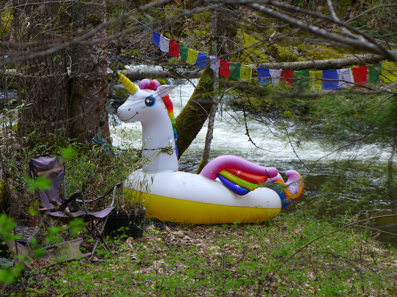
One last note.  We have yet to see a bear or mountain lion on one of our hikes.  But today, for the first time ever, we actually saw the ever elusive Unicorn and got a picture to prove it.  Maybe we will see Sasquatch next!

A very rare photo of the elusive Unicorn - a first for us while hiking!
Trekking Together
Glenn & Carol

Saturday, March 10, 2018

Applegate Ridge Trail (East)

March 10, 2018

Last September we almost hiked the entire Applegate Ridge Trail (east), but stopped less than a mile short in an out and back hike from the Sterling Creek Road TH.  Today we began our hike from the Highway 238 TH access and am happy to report that we hiked the entire trail TH to TH, 11 miles worth.

Where the Applegate Ridge Trail starts along Highway 238
By starting at the Highway 238 TH access, our hike began with a slow but steady climb up to the ridge for about 1.5 miles.  It didn't take long to get warmed up, and since this morning we were shrouded in clouds until we reached the top of the ridge, warming up felt good.

The start of our hike featured much cloud cover and very cool air.

Once on the ridge, the clouds are gone and the views were incredible!


After our climb ended and we made our way through a few forested sections of the trail, we began the best part of the trail, the 3 miles or so that cross the ridges and allow views of the surrounding Applegate Valley and mountains, many that are still snow covered.

Views of snow covered mountains in the distance
Once we arrived at the Sterling Creek Road TH, we had about a 10 minute break before the Friends of the Umpqua Hiking Club arrived from Roseburg.  We then hiked the trail back to our car with the club and enjoyed talking with some of the club members while enjoying the wonderful views from the other direction.

This oak tree has seen better days

One of the many amazing views along this trail

Glenn's favorite tree along the trail


Not too many wildflowers out yet along the trail, although we did see a few Oak Toothworts, Desert Parsley, and some Popcorn Flowers.  Regardless, the views all along the ridge make the hike more than worth it.

Trekking Together
Glenn & Carol


Sunday, May 10, 2015

Mule Mountain Trail

May 3, 2015

Just seeing the words Mule Mountain Trail on a trailhead sign would be enough to stop some folks from even attempting the hike.  Add to that these two facts: 1) Mule Mountain is said to have received its name during the Indian War period when mules, pulling a howitzer (a small artillery piece) supposedly slipped off the trail and fell in to the creek. 2) It was on the Mule Mountain Trail that the Friends of the Umpqua Hiking Club first used the phrase "Richard Hike" to designate a long, uphill both ways, tough hike, which in this case was led by one of it's members - Richard.

So despite all those facts, we decided to call our hiking friend Richard (the same as noted above) and plan a hike up the Mule Mountain Trail -- after all, we have never hiked this trail and how do you know how tough a trail really is until you have hiked it?

After meeting Richard in Ruch, we drove up the Applegate Lake Road to a turnout just past mile marker 12.  Sometimes the trail sign is knocked over which makes finding the trail start a little more challenging, but today it was there in plain sight.....and so the adventure began.

Uphill we go.....lots of tall grass and poison oak along the trail too.
The first 1 - 1.5 miles of trail were uphill, but it was a slow steady uphill, not too bad, as we hiked up through a shaded forest area filled with wildflowers.  Stops were made often on this hike as there was not only a large variety of wildflowers, but also large quantities of each of those varieties!  This trail is a great wildflower hike, but I digress.

Having completed the first "section" of the trail, we then entered the next 1 - 1.5 miles  of trail which was very similar except for one slight difference, gone for the most part were the trees and shady areas -- replaced now by sunshine and heat.  The actual steepness also remained about the same so we were still skeptical about the stories and warnings as noted in the first paragraph of this post.  On we trekked, enjoying Lupines,  Starflowers, Cat's Ear, and the many other wildflowers as well as the incredible views of the surrounding mountians and valleys.

Starflower

Cat's Ear

Lupine


Then we came to the last portion of our 4.2 mile hike out to the base of Baldy Peak.  Still great views....still lots of wildflowers.....still lots of sunshine and increasing heat.......but the trail went into another gear and we found ourselves steeply climbing to  what we could see would be our turnaround point.  It seemed so close, but seemed to take a long time to reach.

After much effort we made it to a lone large tree below Baldy Peak which provided us with shade as we took a much needed break for food & drink.  The toughness of the trail though was quickly lost as we took in the views and the sound of silence during our break.  Occasionaly the wind would blow through and it was so nice just to sit there and take it all in  - it was worth the effort.

One of the many views
But all good things must come to an end and eventually we knew it was time to head back down.  As much as uphill hiking can be tough, sometimes it is the downhill that wears on our knees the most.  So even though our bodies wanted to head down the trail quickly, we had to pace ourselves so that we would live to hike another day.  Once again we were treated to an incredible display of wildflowers and got to see the mountain and valley views that we did not see on the way up.

One of the locals checking us out near Baldy Peak

Yes, the heat does affect Glenn in strange ways!


Yes we were tired after the 8.5 mile hike was done, but we were also glad that we could and did hike this trail.  We fared far better than those mules in the Indian War period and we survived a "Richard HIke" as well. Not bad for one day of hiking.

Trekking Together

Glenn & Carol

P.S. We want to say a special "thank you" to Richard for joining us on this namesake hike and for also sending us some pictures that we could use on our posting.  Please visit Richard's hiking blog by clicking here.  He should have his side of the story posted soon and usually includes a link to pictures of each hike.