Showing posts with label Natural Bridge. Show all posts

Saturday, July 11, 2020

Upper Rogue River Trail #1034 - Natural Bridge to Takelma Gorge

July 8, 2020

We continued with our "wandering Wednesdays" this week with a trip to the Union Creek area.  We took Katie and drove to and parked in the Natural Bridge Day Use area to hike a section of the Upper Rogue River  #1034 trail.

Time to hike on a "wandering" Wednesday

View of the Natural Bridge area
 After taking a short hike to view the Natural Bridge area from the man-made bridge over the Rogue River, we began our trek south along the Upper Rogue River trail.  We hiked past Knob Falls, through the Woodruff Bridge area and made our way to our turnaround point, Takelma Gorge.

Lots of Prince's Pine on this hike

Takelma Gorge, our lunch and turnaround point
Along the way we had great views of the beautiful Rogue River, saw a pair of doe's with fawns along the shoreline, osprey and blue heron flying along the river, and were treated to lots of Prince's Pine, Twin Flowers, Wintergreen, Candystick, Wild Roses and Horsemint too.

The beautiful Rogue River

Candystick
The section from Natural Bridge to Woodruff Bridge did have a number of trees across the trail due to lack of trail maintenance this year, and on the section from Woodruff Bridge to Takelma Gorge we had a few sections of trail that were completely overgrown with shrubs.  Made for some interesting navigation.

Tree blockage along the trail.....

....and overgrown shrubs on other sections of trail.


At Takelma Gorge we took a nice break on some stone ledges to enjoy the sound and view of this area.  We only saw a few other hikers throughout our trek.  Weather was great, although towards the end of our 10.5 mile hike the temps were starting to get up in the low 80's and by then were we tired.  Still it was a great day & an incredible hike along a beautiful river.  Beats work anytime!

Trekking Together
Glenn and Carol


Monday, May 6, 2019

Upper Rogue and Pearsony (or Pearsoney?) Falls


May 5, 2019

Temperatures in the valley were on the rise and with all the snow melted, Union Creek was calling our name.  We took Katie and hiked the Upper Rogue trail from Woodruff Bridge to the Natural Bridge.  This section had a mix of slow moving river and fast, churning white water as the river is very full from all the snow melt.  We made a couple of stops along the trail to explore and get a closer look at some falls, and once at the Natural Bridge Day Use Area we checked out all the viewpoints even though the Natural Bridge was under water.  When we completed our hike along the Upper Rogue, we drove to Prospect and hiked to Pearsoney Falls and a viewpoint of the water cascades coming down the Avenue of the Boulders.  Both were amazing with all of the water!  We thought about stopping to view Mill Creek Falls and Barr Falls, but is was getting hot and with 9.4 miles in the book, we headed home where we enjoyed sandwiches from the Picnic Basket Deli in Shady Cove.  This hike also put us over the 200 mile mark for the year.  Who knows, maybe we will hit 500 miles this year.

Trekking Together
Glenn & Carol


The cascade at Woodruff Bridge where we started our hike.
Dogwood trees were in bloom.

Another cascade about 2 miles into our hike.

Trillium's were numerous along the trail along with Calypso Orchids


Sign has Pearsoney but Oregon State Parks has is as Pearsony - who is right?


Pearsoney Falls.  Notice the falls to the left due to so much water.
View of Rogue River cascading down to the Avenue of the Boulders


Friday, August 12, 2016

Upper Rogue Trail: Natural Bridge

July 31, 2016

As July was coming to an end, we decided to squeeze in one more hike before the month of August arrived with it's typical hot temperatures and wildfire smoke.  So off to the Union Creek area we drove about the time the Bybee fire near Crater Lake started. Yup, August is a comin'.

TIme for another hike
The Upper Rogue trail spans 41 miles from Prospect to the Mt Mazama rest stop and for the most part follows the Rogue River through calm and fast waters.  We have hiked serveral portions, but today we wanted to hike the section from the Natural Bridge parking lot towards the Big Bend TH.  It would be a oneway trip of 7 miles, 14 for an out and back.  We decided to try and hike halfway, take a break and then return.  That was our plan.....

One of our first views of the Rogue River....beautiful!

One of the calm water sections 


We began by hiking the Rogue Gorge trail from the parking lot which took us along the outskirts of the Natural Bridge campground.  Since we started early, we could smell the morning campfires and even the hint of bacon being cooked for breakfast.  But we continued on and did not crash anyone's campsite.

Bridge crossing just above the Natural Bridge campground
Eventually we crossed the Rogue River via a bridge and connected with the Upper Rogue trail to continue our hike.  The river was still very full and made for some beautiful small waterfalls and fast water, especially in some of the areas created by collaspsed lava tubes courtesy of Mt Mazama.

One of the collasped lava tube areas

Small waterfall below the lava tube area

Another beautiful cascade on the Rogue River


As we progressed along the trail, the trail itself became "less maintained" shall we say.  We encounted a couple of downed trees, then overgrowth along the trail, followed by a very overgrown meadow where tht trail had only been maintained by the local cow population.  It is a scary thing to step along a trail you cannot see and know that cows have been there too.....it is only a matter of time till you step on what those cows left behind.  Of course the overgrowth on the trail was especially tough on Katie, since she is only a few feet above the ground!  So when the trail disappeared in the overgrowth which was above our heads, we stopped and turned around.  Just take a look and see if  you can find the trail below!

Where oh where did the trail go???
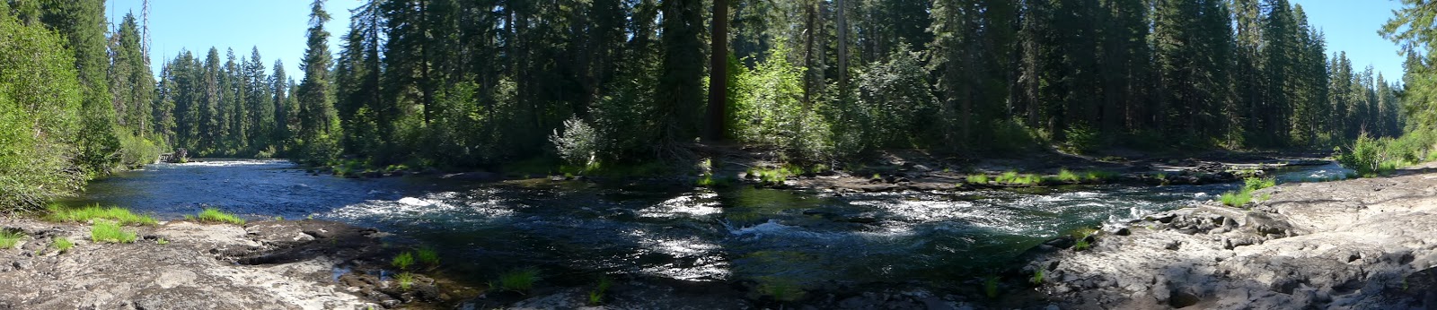
On our return leg we did stop at a spot we had seen earlier where a rocky flat area meets the river.  We got to enjoy great views up and down the river and Katie even took a few quick dips.

Panoramic view of our break area next to the river
When we came to the bridge that we had crossed earlier, we continued on the Upper Rogue trail which took us by the Natural Bridge viewing area and eventually to the parking lot.  The Natural Bridge Falls just below the Natural Bridge area was very full of water and beautiful.

The Rogue River exiting from under the Natural Bridge

The Natural Bridge Falls
We didn't hike as far as we wanted to, but were still treated to great views of the beautiful Rogue River.  And we didn't even notice the smoke from the Bybee fire.  Hopefully that is an omen for hiking in August.

Trekking Together
Glenn & Carol