Saturday, April 29, 2017

Twilight and Greenhorn Trails @ Prescott Park

April 29, 2017

We headed out early to hike at Prescott Park today where we hiked a newly named old-new trail and a newly named new-new trail.

The new Prescott Park Trail System logo
Confused.  We started by hiking the "Nameless" trail that we have mentioned in a couple of past postings and have hiked twice before.  That trail, starting at the first gate, is now called the "Twilight Trail" and has signage at the trailhead showing who can use the trail (hikers, bikers, horses), mileage to connecting trails (if built), and a trail rating of how hard it is (easy, moderate, difficult).

Twilight TH sign
The Twilight trail is 4.3 miles long and takes you around Roxy Ann and eventually puts you on the loop road. It passes through various types of landscapes, each with numerous varieties of wildflowers.

Katie's least favorite wildflower, Cat's Ear

Balsamroot


Once at the loop road, we turned left and hiked the loop road past the rock quarry till we came upon another trailhead sign for the "Greenhorn Trail".  We had seen this trail our last hike here, but there was no info on where the trail went or how long the trail was.  Now that signage and info is listed.  As a matter of fact, there are now large map postings all around Prescott Park that show the new trails as well as the proposed 3 trails to be built in May 2017.


The Greenhorn trail switch-backed us down to where our car was parked, so it was a nice way to finish our hike of 6.1 miles. When we did get done, there were parked cars all the way from the gate back to the power plant area -- for those of you not familiar with Prescott Park, that is quite a few cars -- maybe 60-70?  So join the crowd (or go early and beat the crowd) and get out to Prescott Park to try some of the new-new and old-new trails instead of hiking the loop road.  The wildflowers await you!

Trekking Together
Glenn and Carol

Friday, April 21, 2017

Lower Table Rock - It's Bloom Time!

April 21, 2017

With sunshine in the forecast and Glenn needing an excuse to take a day off work, we headed up to Lower Table Rock for a 5.3 mile hike to check out this year's wildflower bloom.......and we were not disappointed!

Time to hike and see all the wildflowers
We arrived at the parking lot around 12:30 pm and it was completely full - not one spot open.  So we parked in the bus area.  Once we started hiking it didn't take long to see the wildflowers as there were seas of Sea Blush along the lower portion of the trail.

Looking up at the plateau of Lower Table Rock with Sea Blush in the foreground
Along the way we saw many more wildflowers: Fiddleneck, Cat's Ear, Buttercup, Desert Parsley, Camas, Frittilia, Shooting Stars, Houndstongue, Larkspur, Miner's Lettuce, Balsamroot, Fawn Lilies, Saxifrage, Ookow, Monkey Flowers, Cow's Udder Clover and Woodland Star.  Those are the one's we remembered.

Fields of Sea Blush and Popcorn Flowers

The boardwalk segment of the trail on the plateau
Once we arrived at the plateau, we were treated to fields of Bi-Colored Lupine, Goldfield, Blue Eyed Mary and Popcorn flowers that ran along the entire trail to the viewpoint.

Fields of Goldfield

Fields of Bi-Color Lupine and Blue Eyed Mary

And more fields of Goldfield.
There were also still vernal pools full of water among all the wildflowers which enhanced the views.
One of the larger vernal pools with snow covered Mt McLoughlin in the background
We hiked out to the end of the plateau for a view the entire Rogue Valley area.  While taking a break there, we had a visitor who was looking for leftover food from past visitors - or maybe squirrels enjoy seeing all the wildflowers too.

Our little friend at the viewpoint on the Lower Table Rock plateau
So if you are in the mood to see lots of wildflowers and can spare a couple of hours, be sure to check out Lower Table Rock soon.  It is beautiful!

Trekking Together
Glenn and Carol


Tuesday, April 11, 2017

Applegate Lake - Squaw Creek Arm

April 1, 2017

We have hiked many of the trails at or near Applegate Lake.  Stein Butte, Collings Mountain, Payette, Frog Pond, Middle Fork Applegate, Calsh, Osprey, Da-Ku-Be-Te-De to name a few.  But with that being said, we had never hiked the Payette trail around the Squaw Creek Arm of the lake.  Having read postings of a few local hikers who did this portion with snow still on the trail, made us put this hike on our list for when the snow was gone.  Yes, the snow finally melted, the rain ceased for a day, and so we made our way up to Applegate Lake for what would be our second 10+ mile hike of the year.

Time to get out for another long hike......
 We parked at the Dagelma TH and headed down the Osprey trail till it intersects the Payette trail.   Portions of the Osprey trail were still filled with water from the rains and runoffs which made navigation difficult at times.  Once we connected with the Payette trail, we made a left turn and hiked the trail and road till we reached the bridge over Squaw Creek.

The bridge over Squaw Creek.

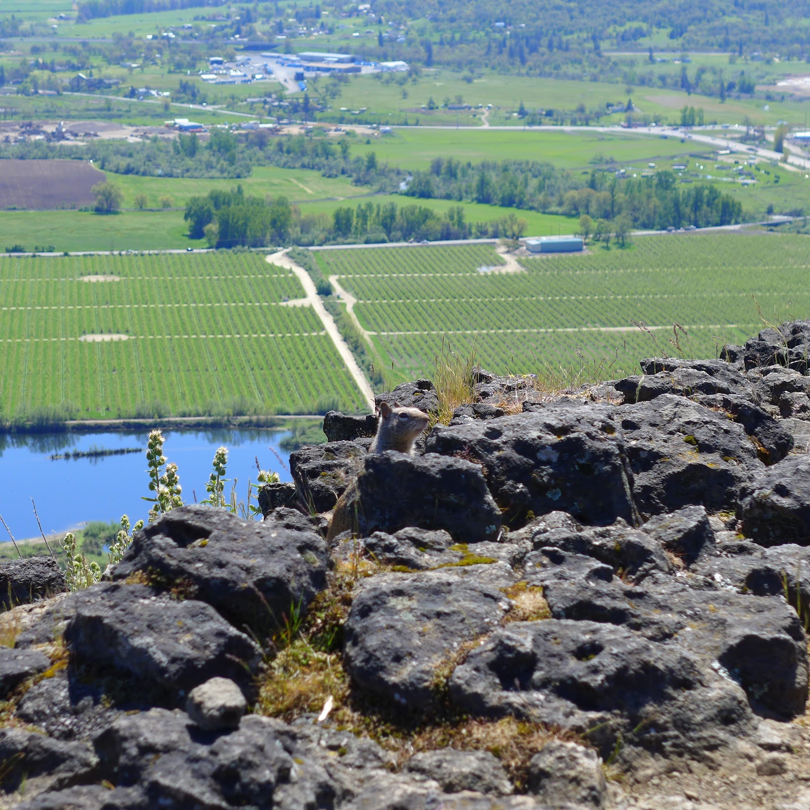
The rest of our hike would follow the boarder of the lake and would eventually lead to the Manzanita TH.  We crossed various creeks and runoffs which for the most part were no trouble.  Despite all the rain this year, the lake was still not completely filled, but it was definitely higher than previous years.

A fuller but not completely filled Applegate Lake
There were lots of wildflowers thoughout our hike and came in clusters depending on the amount of sunshine and type of soil along various parts of the trail.  We saw Avalanche lilies, Grass Widows, Buttercups, Oregon Sunshine, Shooting Stars and some type of Stonecrop.

Avalanche Lilies along the trail
Periodically we caught glimpses of the snow capped mountains in the distance and more than once we disturbed the peacefulness of some ducks and geese along the lake shore. We also passed through a couple of camping areas, one of which had a few campers for the weekend.

One of the camps we passed through while hiking.

View of snow capped mountains in the distance.


One note about hiking this section of trail - we encountered more mountain bikers today than on any other sections or areas when hiking at the lake.  One rider came quickly around a corner and downhill at us while we were trudging uphill and scared us.  No collision occurred and all parties were courteous, but we were very cautious after that encounter.  We also ran into a section of trail that was heavily damaged from the winter storms and had to navigate around and off trail very carefully - a portion of the trail was literally gone!

One last view of Applegate Lake.
One last note too -- the ticks are out now at Applegate Lake!  Glenn even decided to bring one home with him! But don't let that discourage you from getting out there and enjoying a hike and the wildflowers of spring.  Just leave the ticks behind.

Trekking Together
Glenn and Carol

Monday, April 3, 2017

Owl Hoot Trail

March 31, 2017

It didn't take too long for us to return to the Jacksonville Forest Park  - six days to be exact - and try one the many new trails that have been added over the last year.
Time for a hoot of a hike!

We parked in the P2 area and hiked a couple of connector trails till we finally arrived at the Owl Hoot Trail.  Not sure why it is named that, but after a steady steep climb over the first 1.5 miles we began to think that maybe an Owl's Hoot is like a person laughing!

A view along the Owl Hoot trail

The trail itself is only 2.5 miles long but it provided a great workout at the beginning of the hike and then let us take in views of the Jacksonville Hills over the last portion.

View of the Jacksoville Hills from the Owl Hoot rrail

One of the many falls along the Canyon Falls trail
We hiked a couple of other trails to get back to our car which included our favorite, the Canyon Falls trail with it's many waterfalls.  It was a nice 4.5 mile hike, but it proved that even a short hike can be a hoot!

Trekking Together
Glenn and Carol

Stewart State Park

March 28, 2017

Since it was Spring Break week here in Southern Oregon, we made a break for Stewart State Park (officially it is called Joseph H Stewart State Recreational Area) for our first 10+ mile hike of the year.

Even the slugs were out for a Spring Break hike!
We began our hike at the day use parking lot and following the bike path for about 2.5 miles through woods which included many large Madrones and along open grassy fields with some very old oak trees. We got to see (and smelled) a few Yellow Skunk Cabbage flowers while passing a creek in route to Peyton Bridge.

The pretty and stinky Yellow Skunk Cabbage flower

Just before Peyton Bridge we made a sharp left turn and continued following the paved pathway which was now the Rogue River Trail.  This portion follows the Lost Creek Lake shoreline most of the time till arriving at the day use area.  It was also our favorite portion of trail during today's hike as it wandered through thickly forested areas, provided viewpoints of the very full Lost Creek Lake, crossed over various bridges, and passed numerous small creeks and waterfalls.  It was in this portion that we also got a good look at a large Pileated Woodpecker and saw Snow Queen, Yellow Violets and Oak Toothwort wildflowers.

Snow Queen

A very full  Lost Creek Lake

A black fungus thingy!?

Hiking and doing the Limbo Dance on the same trail!!
Once we arrived back at the day use area we decided to continue hiking on the Rogue River Trail towards the dam.  We made Upper Rumley Creek falls our turnaround point (just short of the dam) due to time restraints but made sure to take a few minutes to enjoy the falls beauty and sound.  This side of the lake also had the most tree downfall from the winter storms this year, but we were able to navigate the few trees still across the trail.

Upper Rumley Creek Falls
When our hike ended back at the day use area we had covered 10.4 miles in 4 1/2 hours and only had sore feet which was due to most of the trail being paved.  Not bad at our age. As a reward we stopped at the Picnic Basket Deli located in the Fishin' Hole Fly Shop in Shady Cove and picked up Veggie and Philly Cheesesteak sandwiches for dinner to top off a great day and hike.

Trekking Together
Glenn and Carol