Thursday, May 28, 2015

Big Tree - Mt Elijah - Bigelow Lakes Loop


May 25, 2015

A few weeks ago we had intended to drive down to the Oregon Caves National Monument and do an all day hike consisting of the Big Tree trail and the Mt Elijah - Bigelow Lakes loop trail.  But after calling the visitor center the day before and finding out that there was currently a light snow on Mt Elijah with forecasts of rain-thunderstorms and 43 degree temps on our hike day, we had to forego our planned hike.

But that was then and this is now. Memorial Day weather was forecast for 71 degrees and sunny, the perfect weather for a 10+ mile hike.  So off we went to the Oregon Caves National Monument and another adventure.

Image result for oregon caves national monument sign

We started our hike along the Big Tree trail at the visitor center.  This 3.3 mile loop is a great hike by itself and begins a steady uphill climb the moment you leave the visitor center.  On our clockwise hike out to the Big Tree we began seeing what would be a trend throughout the day -- WILDFLOWERS!  They were everywhere.  By hikes' end we probably saw over 30 different varieties.  We came across large patches of Yellowleaf Iris', Spring Beauty, and more Snow Queens than we had every seen hiking before.  What a start!

After a stop at the Big Tree, we continued on to a couple of connector trails that took us to the Mt Elijah - Bigelow Lakes loop trail.  From the time our hike started till we arrived at the summit of Mt Elijah, the trail seemed to always go up and up and up.  In all we climbed around 2,500 feet in less than 5 miles.  The good news was that after Mt Elijah, the rest of the trail was either level or downhill.

Once we reached Mt Elijah, we took a much needed lunch break and enjoyed the incredible panoramic views of the surrounding mountains and valleys.  We enjoyed the silence during our break, but occasionaly heard the wind in the trees or the frogs from one of the Bigelow lakes below.  We also did our part to add a few cairns around the Mt Elijah sign before continuing our hike.

From Mt Elijah we headed down to the larger of the two Bigelow Lakes,  We took a faint side trail that included some bushwhacking to make it to the shore of the lake.  The frogs sang very loudly until they noticed that we had arrived - then they went quiet.  The lake is very shallow but was pretty with the mountains and Mt Elijah in the background.

The trail wound through various meadows in this area which were currently decorated with large patches of Yellow Fawn Lilies/Avalanche Lilies. We could only imagine that in another month there will be even more color in these already beautiful meadows.

After hiking an abandoned and rocky road, we completed the loop and backtracked on the two connector trails to arrive back at the Big Tree trail.   We completed the last half of the Big Tree trail which was all downhill, to arrive back at the visitor center -- five and a half hours after we started.  We were both very tired but happy to have hiked such a beautiful area.

Since we didn't take pictures (our hike would have been 7-8 hours long if we did), you can click HERE to see some pictures that we found online of another hiker that did this loop during the month of July. The hiker included picutres of various wildflowers, the larger Bigelow lake and views from atop Mt Elijah. His entire album consists of 70 picutres - enjoy!!  If you want to see the various wildflowers that are in the Oregon Caves National Monument, click HERE.

Trekking Together
Glenn & Carol


Sunday, May 24, 2015

Bolt Mountain


May 9, 2015

About once a month we drive over to Grants Pass for various reasons.  While there we usually try to fit in a hike in the area.  These hikes have included Cathedral Hills, Dollar Mountain, Limpy Creek, Waters Creek and Valley of the Rogue State Park.  Recently a co-workers of Glenn's mentioned that he had hiked a 6.4 mile wildflower trail called Bolt Mountain in Grants Pass and had really enjoyed the trail, wildflowers and view.  So on Saturday when we went to Grants Pass, we headed over to Fish Hatchery Park and hiked the Bolt Mountain trail.

The trailhead parking area is considered part of Fish Hatchery Park, so our first stop was to register our vehicle and pay the $5 fee in the park, then drive back to the trailhead.  Not sure what the fine is if  you don't pay the park fee, but the mountain bikers who parked next to us could tell as they had tickets on their vehicles.  More about that later.

The Bolt Mountain trail was built back in 2010 and trail signs were put in as recently as 2013.  It is open to horse riding, mountain biking and hiking.  We saw evidence that horses have been on the trail and as we began our hike a group of mountain bikers were assembling for their ride up to the summit.

Having hiked Mule Mountain a week earlier, Bolt Mountain was definitely not as steep and overall it was a couple of miles shorter.  A lot of the elevation gain came the final half mile to the summit.  The trail wandered through forested areas and meadows where we saw lots of white yarrow, siskiyou iris' and a flower that is very similar to Henderson's Stars named Pretty Face.

Image result for pretty face wildflower
What a Pretty Face!

Since we didn't start our hike till 11:00 am, the open areas of the hike were pretty hot as the sun beat down on us.  This is another hike I would not recommend in the hot hot time of summer.  Dogs are allowed on the trail and even though Katie enjoys hiking, the heat wore on her too.

At various points on the trail as well as on the summit, we were treated to great viewpoints of the surrounding area which included the Applegate River.  The summit itself had a single bench out in the open, so we didn't spend a whole lot of time at the top except to take a quick eating and drinking break.

The overall hike took us about 3 hours and we were tired at the end, but that was mostly the heat and not the climb or distance.  This would be a great hike in Autumn or the March/April timeframe. Although we did not hang around after hiking, Fish Hatchery Park does have picnic tables, a bathroom and is right next to the Applegate River.

We mentioned the mountain bikers at the beginning of this post, so let us finish by telling you that story.  As we began our hike, some mountain bikers were in the day use parking area getting ready to ride up Bolt Mountain.  We were sure they would catch us at some point on the way up and since Katie enjoys chasing bicyclers, we were not looking forward to that meeting.  But alas, we arrived at the summit and no mountain bikers.

As we began hikng back down Bolt Mountain, along came 2 mountain bikers in full gear.  We moved to the side and they passed without incident.  They told us 2 more bikers were coming.  In about 5 minutes we came across the last 2 mountain bikers huffing and puffing as they walked their bikes up the trail.  Made us fell pretty good.  But now the race was on to get down the mountain before the 4 bikers came roaring down the trail behind us!

We were within a half mile of finishing our hike when we heard one of the bikers hollar so once again we moved Katie off trail and let the 2 full gear bikers go flying by us.  It wasn't long till the last 2 and evidently less experienced bikers caught us and passed by.  But before they finished they were off their bikes and walking to the end.  We hiked faster but didn't quite catch up to them.  Still felt good to finish the hike almost at the same time they finished biking and not look half as tired as they did!  Plus, we didn't have tickets on our car for not paying the park fee.

Trekking Together
Glenn & Carol
Sunday, May 10, 2015

Mule Mountain Trail

May 3, 2015

Just seeing the words Mule Mountain Trail on a trailhead sign would be enough to stop some folks from even attempting the hike.  Add to that these two facts: 1) Mule Mountain is said to have received its name during the Indian War period when mules, pulling a howitzer (a small artillery piece) supposedly slipped off the trail and fell in to the creek. 2) It was on the Mule Mountain Trail that the Friends of the Umpqua Hiking Club first used the phrase "Richard Hike" to designate a long, uphill both ways, tough hike, which in this case was led by one of it's members - Richard.

So despite all those facts, we decided to call our hiking friend Richard (the same as noted above) and plan a hike up the Mule Mountain Trail -- after all, we have never hiked this trail and how do you know how tough a trail really is until you have hiked it?

After meeting Richard in Ruch, we drove up the Applegate Lake Road to a turnout just past mile marker 12.  Sometimes the trail sign is knocked over which makes finding the trail start a little more challenging, but today it was there in plain sight.....and so the adventure began.

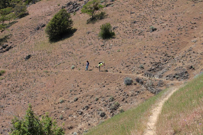
Uphill we go.....lots of tall grass and poison oak along the trail too.
The first 1 - 1.5 miles of trail were uphill, but it was a slow steady uphill, not too bad, as we hiked up through a shaded forest area filled with wildflowers.  Stops were made often on this hike as there was not only a large variety of wildflowers, but also large quantities of each of those varieties!  This trail is a great wildflower hike, but I digress.

Having completed the first "section" of the trail, we then entered the next 1 - 1.5 miles  of trail which was very similar except for one slight difference, gone for the most part were the trees and shady areas -- replaced now by sunshine and heat.  The actual steepness also remained about the same so we were still skeptical about the stories and warnings as noted in the first paragraph of this post.  On we trekked, enjoying Lupines,  Starflowers, Cat's Ear, and the many other wildflowers as well as the incredible views of the surrounding mountians and valleys.

Starflower

Cat's Ear

Lupine


Then we came to the last portion of our 4.2 mile hike out to the base of Baldy Peak.  Still great views....still lots of wildflowers.....still lots of sunshine and increasing heat.......but the trail went into another gear and we found ourselves steeply climbing to  what we could see would be our turnaround point.  It seemed so close, but seemed to take a long time to reach.

After much effort we made it to a lone large tree below Baldy Peak which provided us with shade as we took a much needed break for food & drink.  The toughness of the trail though was quickly lost as we took in the views and the sound of silence during our break.  Occasionaly the wind would blow through and it was so nice just to sit there and take it all in  - it was worth the effort.

One of the many views
But all good things must come to an end and eventually we knew it was time to head back down.  As much as uphill hiking can be tough, sometimes it is the downhill that wears on our knees the most.  So even though our bodies wanted to head down the trail quickly, we had to pace ourselves so that we would live to hike another day.  Once again we were treated to an incredible display of wildflowers and got to see the mountain and valley views that we did not see on the way up.

One of the locals checking us out near Baldy Peak

Yes, the heat does affect Glenn in strange ways!


Yes we were tired after the 8.5 mile hike was done, but we were also glad that we could and did hike this trail.  We fared far better than those mules in the Indian War period and we survived a "Richard HIke" as well. Not bad for one day of hiking.

Trekking Together

Glenn & Carol

P.S. We want to say a special "thank you" to Richard for joining us on this namesake hike and for also sending us some pictures that we could use on our posting.  Please visit Richard's hiking blog by clicking here.  He should have his side of the story posted soon and usually includes a link to pictures of each hike.