February 13, 2016
Here in Southern Oregon we are lucky to have a lot of hiking trails within a driving range of 20 minutes: Jacksonville Woodland Trails; Roxy Ann/Prescott Park; Oredson-Todd Woods; Upper and Lower Table Rocks; and the Jacksonville Forest Park.
 |
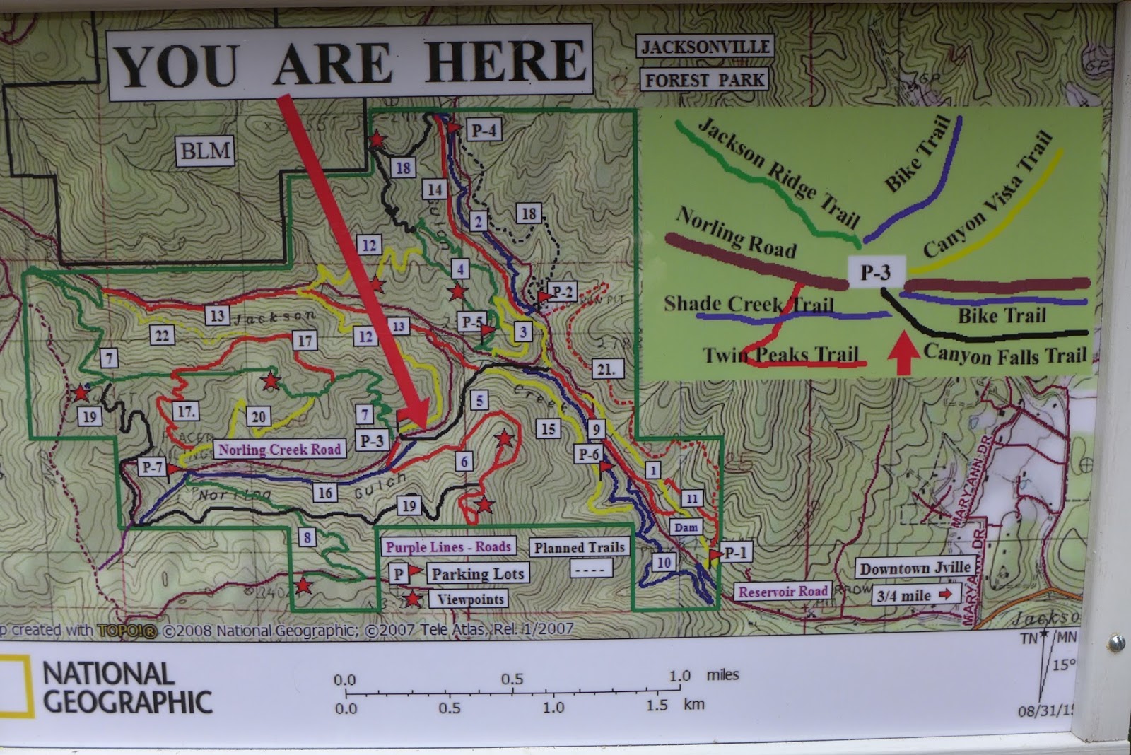
| Main hiking/biking info board at parking area 1 - maps are in the box at lower right |
Of these local hikes, we have hiked the Jacksonville Forest Park the least - maybe 3 times in the last 3 years. This was due to rough roads, the lack of a trail map, and the lack of signage on the trails. However improvements have and are being made, such as additional parking areas along improved roads, trail maps are now available at parking area 1 along with biking route maps based on mileage, and many additional trail signs/pointers have been added along the different routes. They are also expanding the trail network and now have 22 trails with more on the way. So each time you visit, you can create a new hiking route. All of this meant it was time for us to hike at the Jacksonville Forest Park again.
 |
| Oh the places you'll go -- so many options!! |
Despite the cloudy and cool conditions, we enjoyed hiking a 5.4 loop that consisted of eight trails. Here is a brief summary of each segment along with some pictures:
- The Ol' Miners trail was a steep and steady climb from Parking Area 1 up to the ridge. This trail was built on water ditches that were dug 150 years ago by gold miners and takes you through an old mining area with a few pieces of mining equipment left behind.
- The Boulder trail was also built on the water ditches that fed the mining area. Despite the name, we only saw two large boulders while hiking, so maybe the boulder was really under our feet and larger than we thought!
- The Canyon Falls trail (upper segment) was one of the prettiest trail segments we hiked today. It runs along Jackson and Norling Creeks which feature many small waterfalls. With all the recent rains, the creeks were full and there were plenty of waterfalls for viewing and picture taking.
- The Canyon Vista trail was a relatively flat trail that connects two canyons. Despite the name, we noticed very few (if any) vistas during our hike. Of course we did not hike the entire trail, just the first segment, so maybe the vistas are all on the second portion of this trail.
- The Jackson Creek trail was the other favorite trail segment for today. It follows Jackson Creek slowly downhill and much like the Canyon Falls trail, provided us with many small waterfalls to view. This area is also very shaded so there was lots of green along the trail from moss and ferns. Katie enjoyed this segment too since she could wade into the creek which at times is only inches away from the trail.
- The Canyon Falls trail (lower segment) was even better than the upper segment in that some of the waterfalls and water-slides were larger than the upper segment. We would recommend you hike the entire segment if you like the sound of water and enjoy viewing waterfalls. During summer though, this creek is dry, so get out early in the year.
- The Norling trail continues down along Jackson Creek and after crossing a bridge, took us to the upper end of the reservoir. Normally this reservoir is dry, but today it was full of water complete with a few ducks enjoying their own private lake for the Valentine's Day weekend.
- Our last segment was the Rail Trail. In 1916 this route was the site of the Bullis logging railroad. There is even a replica railroad trestle built along the trail at the site of a train wreck in 1917.
Trekking Together
Glenn & Carol
P.S. Check out this 4-minute video on YouTube by a local news station on the Jacksonville Forest Park ---
https://www.youtube.com/watch?v=ouLrbXingrY


Nice to get out on the trails these days, isn't it?
ReplyDeleteP.S. You guys have hiked more miles than I so far in 2016!
ReplyDeleteThis comment has been removed by a blog administrator.
ReplyDelete