Showing posts with label Pacific Crest Trail. Show all posts

Thursday, June 18, 2020

PCT - Ashalnd Meadows/Grouse Gap Segment

June 17, 2020

Glenn took another Wednesday off and this time we hiked without Katie since these longer hikes seem to do her in.  We drove up towards Mt Ashland and hiked an out and back on the Pacific Crest Trail, a segment known as Ashland Meadows (due to the varioius meadows with wildlflowers along this trail) or Grouse Gap (since most folks turn around at the Grouse Gap Shelter for a nice 6.8 miles hike). We were actually a little early for the full blooming of wildflowers although there were plenty to see including Larkspur, Pussy Paws, Wallflower, Skunk-leaved Jacob's Ladder, Blue Stickseed, Mission Bells, a Dwarf Lupine and many more. About 2-3 weeks from now should see the wildflowers at their best. As we began our hike there was some leftover ice/snow from the recent storm, but that soon gave way to plenty of sunshine, blue skies and temps around 62 degrees --- beautiful!  We had views of snow-covered Mt Shasta to the south and there was plenty of run-off water crossing the trail.  We did meet one PCT hiker who started in Castle Crags SP in Northern CA and was planning to go all the way to Canada.  He ran into 5" of snow in Seiad Valley a few days ago.    We had a beautiful 11.4 mile hike as we went a few miles past Grouse Gap (after a break at the shelter) before deciding it was time to turn around.   We wanted to just keep going!  Hope you enjoy the pictures.

Trekking Together
Glenn & Carol

The old familar trail sign at the start of the Grouse Gap hike.

First meadow comes into view.

View of Mt Shasta to the south

Wallflower

PCT indicator

Trail segment past the Grouse Gap Shelter

The elusive but beautiful Mission Bells

Grouse Gap Shelter and Restroom

View at our turnaround point

Monday, May 29, 2017

Hobart Bluff

May 21, 2017

Last year we hiked twice from the Green Springs Summit area. First a short hike on the Green Springs Mountain Loop trail (2.9 miles) and then a week later a 10+ mile hike north along the Pacific Crest Trail to Little Hyatt Lake.  Both were beautiful hikes filled with wildflowers.  This year we decided to start another hike at the Green Springs Summit, but this time head south on the Pacific Crest Trail and visit Hobart Bluff.

Time to hike!
We arrived early in the morning as we wanted to be done hiking before the heat (seems strange to say that) arrived, but were surprised that upon arrival the winds were really blowing.  It felt like being at the coast! Our hike south along the PCT begins by passing between private properties, so we stayed strictly to the trail and enjoyed hiking through open meadows as well as shaded forested sections.

A warning to the wise.
The early wildflowers have come and gone in the lower elevation Rogue Valley area, but here at the summit it was like going back in time.  We got to see Snow Queen, Yellow Violets, Fawn Lilies, Cat's Ear, Trillium and Buttercups again as the spring wildflower parade was just beginning.  As a matter of fact, we were surprised as we came across a few snow patches along and on the trail which Katie really enjoyed.

First little patch of snow along our hike.


A beautiful trillium

PCT passing through one of the meadows
After about 3.5 miles of trail, we came to the Hobart Bluff overview trail and made a right turn.  This side trail to the bluff may be short, but if was also steep. Along the trail to the bluff there were lots of Phlox and bright yellow Balsaamroots as well as even more wind!  We even found a cairn which caused Katie to celebrate. We took a break on the bluff and enjoyed views of Mt McLoughlin, Mt Ashland, and Mt Shasta.

The trail  UP to Hobart Bluff begins

Balsaamroot

Katie celebrating a Cairn

View of Mt McLoughlin from Hobart Bluff

On our return leg of the hike we came across at least four other pairs of hikers.  It was nice to see so many people getting out and enjoying the trails.  In terms of wildlife along the trail, we did scare a pair of deer, had a Northwest Tree Frog cross out path, and ended with a lizard posing long enough to have his picture taken.

Pacific Tree Frog
A lizard that holds still.
We really enjoyed hiking the PCT to Hobart Bluff and have put this hike on our list of "hike-agains".  If  you ever get the chance, be sure to visit the Green Springs Summit area and try one of the many hikes available. Whether it's a short, mid-range, or long hike, we're sure you will enjoy all the beauty and views this area has to offer.

Trekking Together
Glenn & Carol


Wednesday, July 13, 2016

PCT: Ashland Meadows--Grouse Gap--Siskiyou Summit

July 6, 2016

10.4 Miles

Since our first 10+ mile hike of the year was done over the Memorial Day weekend and was on the Pacific Crest Trail, we decided to venture out for our second 10+ mile hike over the Fourth of July weekend on the Pacific Crest Trail - just a different segment. For those of you checking, July 6th was a Wednesday. But for Glenn it was part of his company holiday weekend.

To Grouse Gap and beyond!!!
Having checked our hiking history, we found that the last time we hiked the Ashland Meadows-Grouse Gap segment of the PCT was 5 years ago.  It is a very popular segment due to the easy access and the amazing meadows filled with wildflowers.  Hiking out to the Grouse Gap Shelter road and back makes for a nice 6.8 mile hike, but today we decided to go a little further down the trail.

Katie (bottom center) checking out the first meadow.
We parked just off the main road to Mt Ashland after mile marker #7 (this is where the PCT crosses the road) and after crossing the road began hiking the PCT southbound.  The temperature was just 49 degrees when we started with beautiful blue skies - perfect hiking weather.  The trail from our parking point till the Grouse Gap Shelter road travels through either wooded forest segments or open meadows of varying sizes where a wide variety of wildflowers abound during the summer.

One of the many wildflower meadows that make this a great hike!
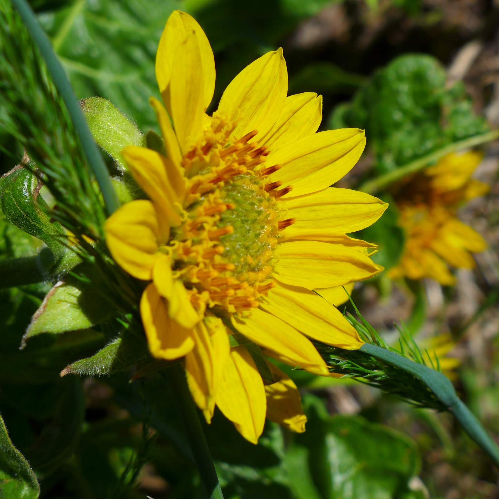
Some of the unique wildflowers that we saw while hiking included Richardson Geraniums, White Bog Orchids, Orange Agoseris, Cotton Paintbrush, Pussy Paws, Monkshood and Western Bistort.  The most numerous wildflower today was the Scarlet Gilia or "Skyrocket" which appeared in large patches along the trail. Below are some of the wildflowers we saw on today's hike.

Scarlet Gilia "Skyrocket"


Monkshood

Western Bistort

Richardson Geranium


Larkspur


Cobwebby or Cotton Paintbrush


Just before reaching the Grouse Gap Shelter road, we met a couple in their 60's that appeared to be backpackers.  So we stopped and asked them where they had started their hike to which they replied "Mexico".  This surprised us since most of the PCT thru hikers are still 3 or more weeks away from arriving in Oregon due to the heavy snowfall in the Sierras.  However this couple had skipped that segment, thus their early arrival.  We asked what their trail names were to which their reply was "So Far" and "So Good"  Pretty cute!

PCT Thru Hiker trail magic
Normally we turn around at the Grouse Gap Shelter road but today we continued on for a couple of "new" miles to us along the PCT.  The trail began with a steady climb as the segment begins to ascend up to the Siskiyou Summit.  When our trail finally flattened out, we came across a couple of chairs and ice chests that were set up as "trail magic" for PCT Thru hikers.  All of the ice cold drinks had already been consumed, so hopefully they will refill the ice chest in the next week or two.

View of trail in open area leading up to the Siskiyou Summit
This part of our hike was also more open with less trees due to the higher elevation.  A couple of times we heard bells and thought maybe we were losing our minds in the thinner air, but discovered that a group of cows down a ravine were the noise makers.  We didn't hike all the way to the summit, but eventually found a nice place off trail to take a break, eat, and enjoy the views and quiet.  We even saw a couple patches of snow!!

The view during our break.

See the snow??????
Our hike back gave us another chance to enjoy the wildflowers.  Since it was later in the day, the meadows were also alive with many butterflies and busy bumble bees.

One of the many butterflies enjoying the wildflowers.
If you get a chance to try this hike, the best time is usually June - August when the various wildflowers bloom.  Get out and enjoy!!

Trekking Together
Glenn & Carol

P.S. In 2009, Glenn hiked this trail on the first day of Summer with his brother and nephew.  It was 32 degrees and snowing.  Yes they still hiked out to the Grouse Gap Shelter road and back and met many other hikers out for a "summer" hike.  Here are a couple of pictures from that hike.


Thursday, May 19, 2016

Green Springs Mountain Loop Trail

May 1, 2016

We have hiked at various places in or around the Ashland area such as Grizzly Peak, Oredson Todd Woods, Lithia Creek, Ashland Meadows and Wagner Butte, but have never hiked trails near or around the Green Springs Summit.  So when our sister Karen wanted to join us for a hike, we decided to head for the Summit and try a new short loop trail called the Green Springs Mountain Loop.
A sign that says "it's time to hike".
 Although the Pacific Crest Trail has been around for some time, a few years ago a connector trail was added which connects two points of the PCT to form a loop.  Although only 2.9 miles long, the loop allows you the opportunity to hike the PCT and get a sampling of the beauty in this area.  It's also a great hike for the family.

A birdseye view of where we were and the loop trail
After taking a few short side roads from the summit on Highway 66, we arrived at the trailhead parking lot which has room for about 6 vehicles.  It was just a short walk down the road to where the Pacific Crest Trail comes across the road and heads north to start our hike.


The PCT quickly arrives at a "fork in the road" and you can hike the loop in either direction.  We decided to hike counter-clockwise and start with the connector trail and then hike the PCT south back to the starting point.

Blue skies and white puffy clouds - beautiful day for a hike!

The connector trail is a mere .75 miles but takes you through beautiful wooded areas where we saw Trilliums, Snow Queen and Yellow Violets along the trail.  We did have to cross a few down trees, but that is typical this early in the hiking season.  We also had to pass through one gate which was either to keep cows out or the hikers in - not sure which.

Katie leading the way through one of the meadows on the PCT

It didn't take long till we intersected with the PCT again.  You can continue north on the PCT from here and hike a couple of miles to Hyatt Lake, but for our hike we made a left hand turn and took the PCT south for about 2 miles till it met the connector trail intersection to complete the loop.

Mission Bells

Even though some parts were through wooded areas again, the trail does take you through a couple of meadows that allow you wonderful views of the surrounding mountains and Pilot Rock.  We saw a few more varieties of wildflowers in these meadows like Larkspur, Fawn Lilies, and Ballhead Waterleaf. We were even treated to a pair of Mission Bell flowers --  a sight we have seen very few times while hiking.

View of Pilot Rock
When our loop was completed, it was just a short hike down the road and back to our car.  Our hike lasted a mere 90 minutes but provided us with some wonderful views, beautiful woods and flowers, and whetted our appetite to return to the summit and hike the PCT to either Hyatt Lake (north) or Hobart Bluff (south).  Look for that posting in the near future.

Trekking Together
Glenn & Carol